Report anchorages: Here’s how
The ADAC port database
The ADAC ports database includes around 3,500 ports worldwide. Changes and innovations are checked with the harbormasters every year. In addition, ADAC port inspectors regularly tour the areas, record new ports and get an on-site picture of changes, expansions, infrastructure and equipment of the marinas and ports.
Anchorages are also included in the ADAC harbor database. However, it is mainly the users and skippers who are in demand here, who can report their most beautiful anchorages easily and uncomplicatedly via our skipper portal. Participation is therefore called for.
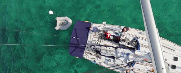
Here we have created a quick guide on how to report and enter anchorages, using an example on Brandenburg’s Breitlingsee.
Select the anchorage on the map
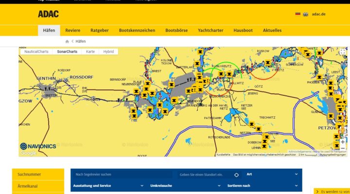
First, call up the port page of the ADAC Skipper Portal in your browser.
In the blue search mask below the map you can enter the desired area and confirm the ENTER key. Alternatively, you can automatically select your location if you want to make the report directly from the anchorage.
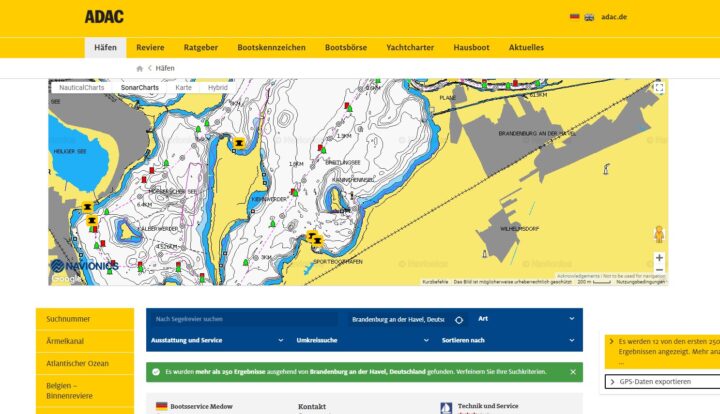
After that, the section appears on the map, in the view of which they can switch between satellite map (hybrid), Navionics sea chart and Google Maps. Use the mouse scroll wheel, touchpad, two-finger zoom on touchscreens, or the +/- buttons in the map to zoom in. Now find the exact position on the map.
The reporting function
Once you have found the position of the anchorage click in the map. Then a green-white bollard symbol appears and the reporting function menu with the items: “Port … Report” and “Anchorage … report”. Click on “Report anchorage”.
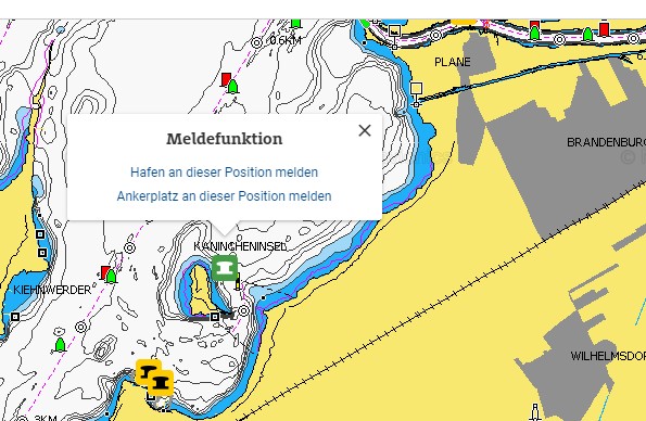
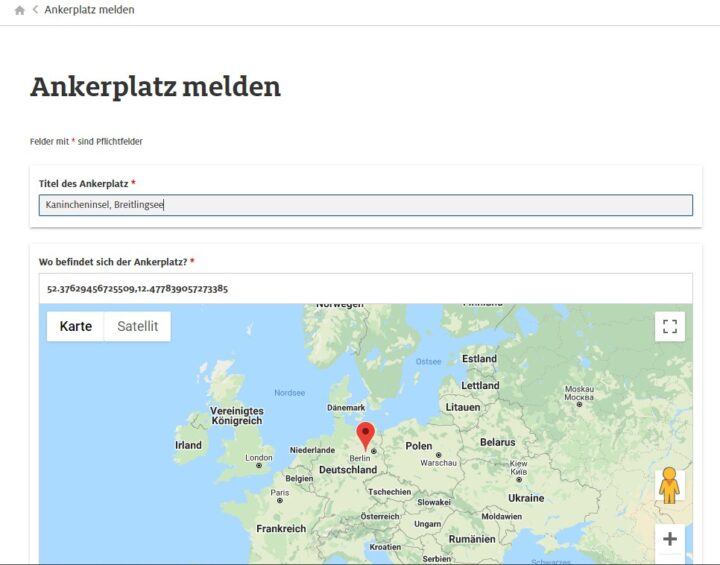
After that, a new browser window opens with the message page, where the details are entered. The position is taken over on the map, if necessary zoom into the map again to check.
Information and details about the anchorage
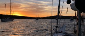
On the message page you will find several fields to fill in. First, give the anchorage a name. In this example, “Rabbit Island” for the exact position and “Breitling Lake” for the precinct. For the naming is suitable on the information on the nautical charts, such as the name of the bay, an island or a nearby place.
The exact position data is generated automatically.
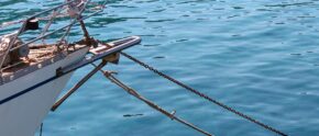
Next – if available – are special features for the control. Shoals, landmarks and special features can be entered here. In our example case, a buoyed fairway leads to the vicinity of the anchorage.
Texture
The most important factors for anchoring are the nature of the anchoring ground and the wind directions for which the anchoring site is suitable. Here you will find three fields to check:
- Anchor ground
- Safe in winds from (direction)
- Unsafe with winds from (direction)
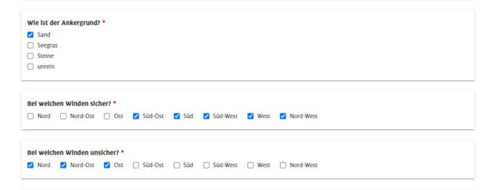
In the case of our example, when the wind is from the south and southeast, there is coverage from the near shore. Only in easterly, northeasterly and northerly winds can it become unsafe at this spot due to the wave that is created. The checkmarks are set accordingly.
Infrastructure
Next is information about the infrastructure near the anchorage. Are there utilities available nearby? Is there a resuatant or a city? And is it even worth going ashore with the dinghy? Information on accessibility such as access roads or parking spaces in the vicinity, for example, if a new crew member wants to board, can also be entered here.
Photos from the anchorage
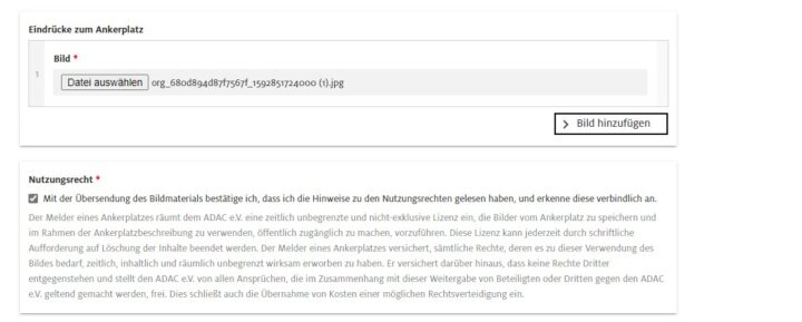
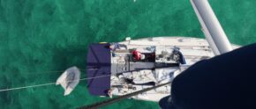
In the last step you can upload – if available – photos of the anchorage and the surrounding area. These can be photos of the bay, anchored boats or even landmarks. First click on “Select file”. After that, the file view of your PC or smartphone will open. Select a photo here. The file name will be displayed after successful selection. To upload more images, click on “Add image” for each new photo on the right.
Please do not forget to tick the “Right of use” box so that the images can also be published on the portal. Please upload only your own photos to which you own the rights of use.
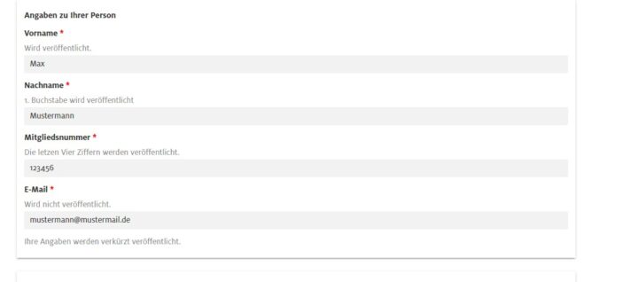
Information about yourself
In the last field, please enter the information about yourself. On the portal will later only the first name, the first letter of the surname. if applicable, the last four digits of your ADAC membership number. We only need your e-mail address in case of further questions – it will not be displayed on our website.
Now the report is also almost completed and only two steps are waiting:
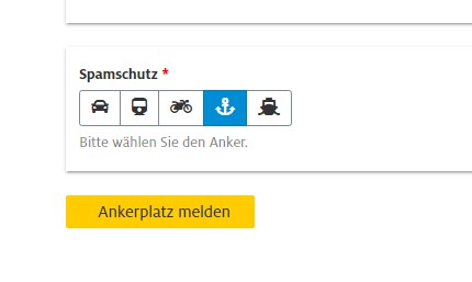
Finally, to make sure that the messages are not spam, you need to select and click on an image. In our example, we ask for the image with the anchor. Click on the anchor so we know that they are also a real person and not a so-called “bot”.
The best thing to do now is to check the information you have entered again. If everything is entered correctly, click on the yellow button “Report anchorage” to send your report.
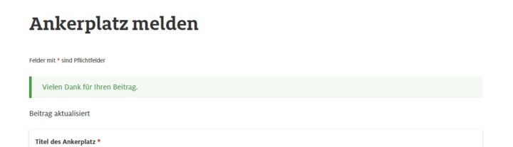
Thank you!
If you have filled in everything, a confirmation will now appear that the message has been received. Now only one thing remains for us to say:
Thanks for joining us!
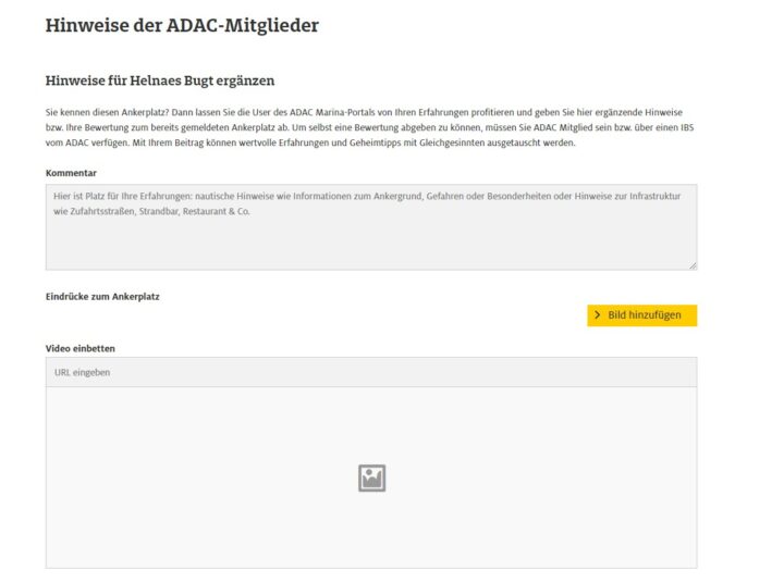
Comment function
ADAC members have the possibility to add comments to already existing anchorages. If, for example, a bay has silted up, the approach has changed or other information is available, you can enter it in the comment field for each existing anchorage. Pictures and videos can also be added.